Picture Galleries
Some boundary stones in Calderdale
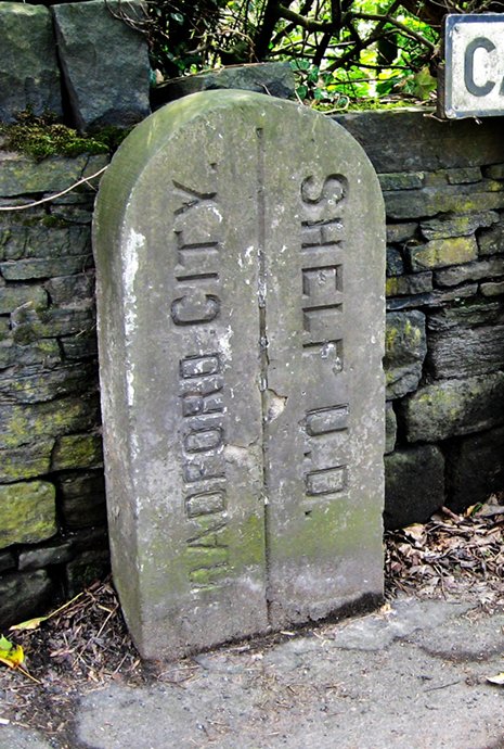
Halifax was one of the largest parishes in England, covering an area almost exactly the same as the present-day Calderdale. It was divided into 23 townships, and many boundary stones survive, of which these are typical examples.
| On Stainland Road (B6112) just outside West Vale Grid Reference: SE 091 207 National ID: not yet registered |
On a bridge at the junction of Norland Road and Turbury Lane, this stone reads: "Division of Norland and Elland". Grid Reference: SE 070 220 National ID: not yet registered |
This boundary stone is one of several now in the grounds of Clay House, West Vale. Grid Reference: SE 097 214 National ID: not yet registered |
||
 |
||||
| There are many of these stones on the boundary of Soyland township. Grid Reference: SE 013 213 National ID: not yet registered |
This stone stands at the junction of Deep Lane and Butts Green Lane. NB: Luddenden Foot was not an original township, but part of Midgley. Grid Reference: SE 048 252 National ID: not yet registered |
This stone survives on the A6036 road between Halifax and Bradford. Grid Reference: SE 116274 National ID: not yet registered |